May 12, 2026
The “Spatial Blind Spot” in Global Health
In global health, data drives decisions. But in public health emergencies, data without location context is difficult to act on. For decades, one of the biggest challenges in disease surveillance has not been the absence of information, but the inability to clearly identify where risks are emerging and where interventions are needed most.
In many health systems, surveillance reports may arrive on time, but without geographic context, response teams still struggle to identify which communities are most at risk and where resources should be prioritized.
When decision-makers cannot visualize exactly where a risk is emerging, resources are distributed broadly and inefficiently rather than aimed surgically. In the high-stakes environment of an outbreak, location is the ultimate variable for risk, vulnerability, and priority. When outbreaks spread across hard-to-reach or underserved communities, delays in identifying affected locations can slow coordination, stretch limited resources, and increase vulnerability for already at-risk populations.
Intervention: Geospatial Intelligence as an Operational Core
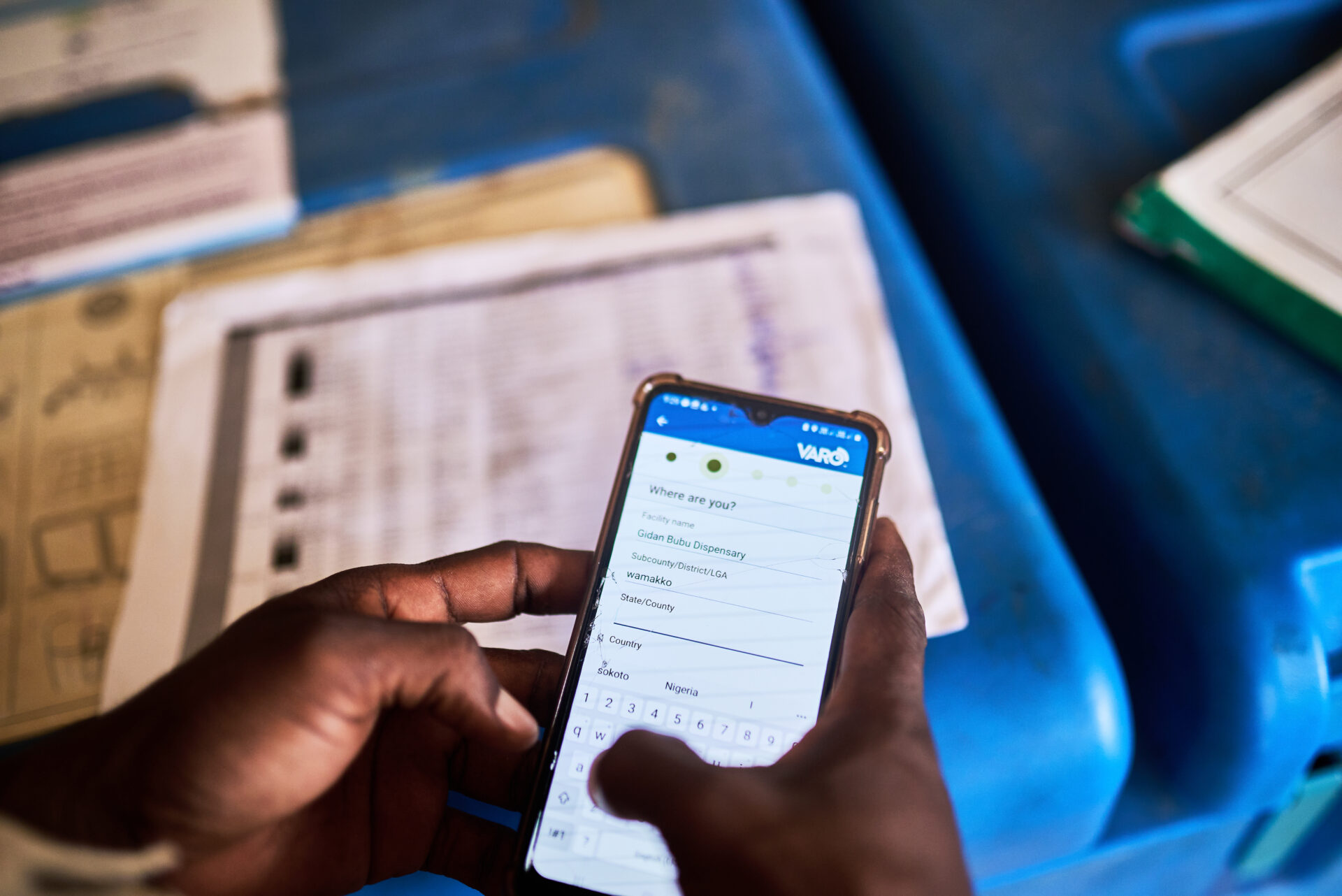
eHealth Africa (eHA) is helping public health teams move beyond static reporting toward real-time operational intelligence. We are integrating geospatial intelligence into the day-to-day operations of Public Health Emergency Operations Centers (EOCs).
Rather than using maps only for retrospective reporting, eHA supports the use of dynamic geospatial dashboards within the daily workflow of health officials and emergency coordination teams.
This integrated approach brings surveillance data, logistics tracking, and partner coordination into a shared operational view that supports faster and more informed decision-making.
This is the centerpiece of our Public Health Emergency Management (PHEM) 2026-2028 Strategy, specifically our pillar on Strengthening Data Systems and Epidemic Intelligence.
Key Components of the Intervention:
- Real-Time Surveillance Layers: Combining epidemiological trends with population and infrastructure data to identify high-risk areas more quickly.
- Integrated EOC Dashboards: Providing Technical Working Groups with a shared operational picture to support coordinated decision-making in real time.
- Predictive Logistics Mapping: Tracking facility readiness and supply gaps to improve the delivery of critical supplies to underserved communities.
Evidence: Intelligence in Motion
The impact of geospatial integration can be seen in how the Emergency Operations Centers we support coordinate surveillance, logistics, and response activities more efficiently.
“By placing visual intelligence at the center of the workflow, we eliminate the ‘he-said, she-said’ of coordination. Everyone sees the same map, speaks the same language, and moves toward the same goal.”- Abuja EOC Manager
By operationalizing this data, eHealth Africa has observed improved coordination and faster visibility into emerging risks through the use of geospatially enabled systems.
When uncertainty is replaced by clarity, the entire system accelerates. Our internal benchmarks indicate that geospatial integration allows for:
- Infant-stage risk spotting: Identifying anomalies before they scale into outbreaks.
- Zero-waste logistics: Visible “gaps” on the map ensure partners no longer duplicate efforts or overlook remote settlements.
From Reactive Reporting to Coordinated Intelligence
Traditional public health systems often rely on fragmented reporting processes, making it difficult to identify emerging risks and coordinate responses effectively and quickly. By integrating geospatial intelligence into Emergency Operations Centers, eHA is helping shift outbreak response toward more predictive surveillance, coordinated operations, and targeted resource deployment.
This transition enables health teams to:
- move from reactive reporting to proactive monitoring,
- improve coordination across partners and agencies,
- identify service and supply gaps more quickly,
- and support faster decision-making during outbreaks.
Why It Matters: System-Level Impact
This is more than a technical upgrade; it represents a shift toward faster, evidence-informed public health decision-making. By turning coordinates into clarity, eHealth Africa is shifting the public health landscape from reactive firefighting to predictive coordination.
Strengthening epidemic intelligence through geospatial systems ensures that national and subnational teams can interoperate seamlessly. At the system level, this reduces the cost of response, minimizes the duration of outbreaks, and most importantly, saves lives by reaching the most vulnerable populations with surgical precision.
The Bottom Line: Geography is the ultimate language of coordination. At eHealth Africa, we are using that language to turn data into decisions and decisions into a healthier future for all.